logo image
  • Home
  • Services
    • Wreck Diving Philippines
    • Liveaboard Diving Philippines
    • Yacht Charter Philippines
  • Equipment
    • Wassp Multibeam 3D Sonar
    • Geometrics 882 Magnetometer
    • Blue ROV
    • EdgeTech 4125i Sidescan Sonar
  • Our Vessels
    • MV Jazmin
    • Caribbean Tigress
  • About Us
  • Blog

Bathymetric and Hydrographic Survey Equipment Philippines

Finding the right equipment can make a big difference when a marine survey needs accurate seabed data. Jazz Marine provides bathymetric and hydrographic survey equipment in the Philippines for projects that need underwater mapping, depth measurements, seabed detection, underwater inspection, and marine search work. Our equipment can support projects around Manila Bay, Cebu, Lapu-Lapu, Mactan Channel, Subic, Batangas, Palawan, Davao, and other coastal areas across the Philippines. Philippine waters can change quickly from one location to another. Rocky seabeds, coral areas, deep channels, strong currents, poor visibility, and heavy vessel traffic can all affect a survey. The right sonar, positioning system, magnetometer, or ROV helps survey teams collect better data and make safer decisions.
bathymetric and hydrographic survey equipment in the Philippines

Hydrographic Survey Equipment Philippines

When people search for hydrographic survey equipment Philippines, they are often looking for more than a list of machines. They want to know which equipment can map the seabed, find underwater objects, inspect structures, or support a marine construction project. Hydrographic survey equipment is used to measure and map underwater areas. Depending on the project, a survey may use multibeam sonar, side scan sonar, magnetometers, ROVs, GNSS positioning, sound velocity equipment, and other marine sensors. Jazz Marine works with equipment suited for different underwater survey needs. The right setup depends on water depth, seabed type, required accuracy, survey area, and the type of information the client needs.

When is hydrographic survey equipment needed?

Hydrographic equipment can be used for:
  • Port and harbor surveys
  • Coastal mapping
  • Bathymetric surveys
  • Seabed mapping
  • Dredging surveys
  • Marine construction
  • Cable and pipeline route surveys
  • Wreck location
  • Underwater archaeology
  • Search and recovery work
  • Environmental surveys
  • Underwater inspection
  • Marine engineering projects
A shallow coastal survey may need a different setup from a deep-water mapping project. This is why equipment should be matched to the actual site and survey goal.

Bathymetric Survey Equipment Philippines

Bathymetry focuses on measuring water depth and creating a map of the underwater surface. For a project in the Philippines, this can help show changes in seabed elevation, channels, slopes, sand bars, rocks, and other underwater features. Bathymetric survey equipment Philippines projects may use single beam or multibeam echo sounders. Multibeam systems can collect many depth measurements across a wider area during each survey line. This type of data can help engineers and survey teams understand what is below the water before construction, dredging, or other marine work starts.

What can a bathymetric survey show?

A bathymetric survey can help produce:
  • Water depth measurements
  • Seabed elevation maps
  • Contour maps
  • Digital terrain models
  • 3D seabed views
  • Channel profiles
  • Depth charts
  • Survey points for CAD or GIS work
For areas around ports such as Cebu, Manila, Subic, and Batangas, accurate depth information can be useful when planning marine construction and vessel operations.

Our Bathymetric and Hydrographic Survey Equipment
bathymetric survey instrument
sonar equipment for water surveys

Wassp Multibeam 3D Sonar

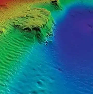
The WASSP Multibeam 3D Sonar is used for detailed bathymetric surveys, seabed mapping, and underwater terrain profiling. It collects depth data across a wide area, helping survey teams create a clearer picture of the seafloor.
  • Fast Profiling: Collects seabed data across a wide survey area.
  • Real-Time 3D Mapping: Helps visualize reefs, wrecks, underwater objects, and changes in seabed shape.
  • Comprehensive Data Collection: Detailed Bathymetry: Provides depth and seafloor topography data for marine construction, research, exploration, and underwater asset surveys.
hydrographic survey equipment
depth sounding instruments

Geometrics 882 Magnetometer

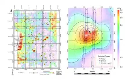
The Geometrics 882 Cesium Vapor Magnetometer is used to detect and map ferrous objects beneath or near the seafloor. It can support underwater searches where metallic targets may be difficult to locate through visual inspection alone.
  • Wide Application: Can help detect anchors, chains, cables, ballast stones, UXO, and other ferrous objects.
  • Cesium Vapor Technology: Provides high sensitivity for magnetic surveys in shallow and deep-water environments.
  • Accurate Data Display: Displays GPS position and magnetic field information to help locate detected targets.
unmanned surface vessels (USVs)
water depth measurement devices

Blue Remote Operated Vehicle (ROV)

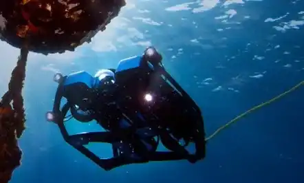
The Blue Robotics Tethered Heavy Configuration ROV supports underwater inspection, object retrieval, and visual surveys. It can operate at depths of up to 100 meters with a 300-meter cable drum, based on the equipment specifications provided by Jazz Marine.
  • High-Resolution Imaging: Uses low-light cameras and a 4K video camera for underwater inspection.
  • Precision Manipulation: Includes a grab manipulator arm for interacting with underwater objects.
  • Versatile Capabilities: Can be fitted with additional scientific equipment for specific underwater missions.
hydrographic surveying tools
bathymetric mapping systems

EdgeTech 4125i Sidescan Sonar

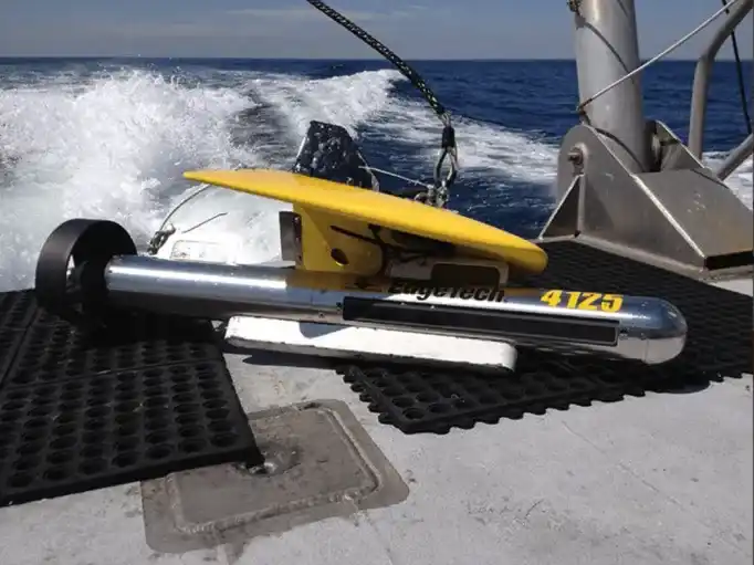
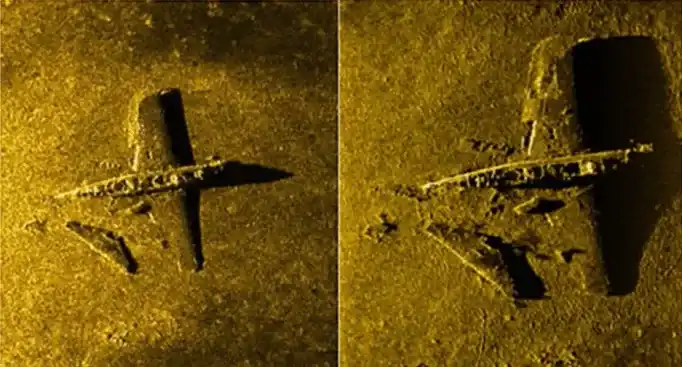
The EdgeTech 4125i Side Scan Sonar is used for high-resolution seabed imaging and underwater target detection. It can help survey teams locate shipwrecks, cables, debris, rocks, and other features on or near the seafloor.
  • Wide Coverage: Provides coverage on both sides of the survey path.
  • Highly Detailed Graphics: Produces clear bottom imagery that can be recorded and reviewed for further analysis.
  • Precise Target Identification: Helps identify and locate underwater objects using position and depth information.
subsea survey tools

Port and Harbor Surveys

Ports have busy waters, moving vessels, dredging activity, and changing seabed conditions. This makes accurate underwater information useful for marine construction and port planning. Hydrographic equipment can help survey teams map channels, measure depths, identify seabed features, and monitor areas affected by dredging. Jazz Marine can support hydrographic survey equipment needs for areas such as Manila Bay, Cebu, Mactan Channel, Subic Bay, Batangas, and other Philippine coastal locations, subject to project requirements and equipment availability.

Coastal and Seabed Mapping

The Philippines has thousands of islands and a large number of coastal communities. Coastal areas can have very different seabed conditions, even across relatively short distances. Sand, rock, coral, mud, seagrass, and other seabed types can affect survey work. Weather and sea conditions can also change the way a survey is planned. Bathymetric and hydrographic equipment can help create a clearer picture of underwater conditions before marine construction, coastal engineering, environmental work, or other projects begin.

Dredging Surveys

Dredging removes sediment from the seabed to maintain or increase water depth. Survey data can be used before, during, and after dredging to show how the seabed has changed. Bathymetric equipment can help create depth maps and calculate changes in seabed levels. This information can support dredging plans, progress checks, and post-dredging surveys. For a dredging project, the survey team may need to compare multiple bathymetric datasets over time. This makes accurate positioning and consistent survey methods very important.

Shipwreck and Underwater Archaeology Surveys

The Philippines has a long maritime history, with many known and undiscovered underwater sites. Shipwreck surveys can require several types of equipment. Side scan sonar can help locate seabed targets, multibeam sonar can show the shape and depth of the area, and a magnetometer can help detect metallic objects. An ROV can then provide underwater video or close-up inspection of a selected target. Using several survey methods can give the project team more information than relying on only one sensor.

Underwater Search and Recovery

Underwater search work can involve missing equipment, vessels, wrecks, debris, or other objects. The survey method should match the target. A side scan sonar can help locate objects on or near the seabed. A magnetometer can help identify magnetic targets, while an ROV can be used for visual inspection after a target is located. This combination can help reduce the search area and give the team better information before an underwater inspection.

Bathymetric and Hydrographic Survey Equipment Comparison

Equipment
Main Purpose
Useful For
WASSP Multibeam
Seabed depth and mapping
Bathymetry, ports, channels, dredging
EdgeTech 4125i
Seabed imaging
Wrecks, cables, debris, seabed targets
Geometrics 882
Magnetic target detection
Wrecks, metallic objects, search work
Blue ROV
Underwater inspection
Structures, wrecks, cables, visual inspection
Each system collects different information. A project may use one system or combine several systems depending on the survey objective.

How to Choose Hydrographic Survey Equipment in the Philippines

The cheapest equipment is not always the right equipment for a marine survey. The survey area, water depth, target type, required accuracy, vessel, weather, and final deliverables all affect equipment selection. Before choosing equipment, ask these questions:
  • How deep is the survey area?
  • Do we need depth data, seabed images, or both?
  • Are there known underwater targets?
  • Does the project involve a port, channel, coast, wreck, cable, or pipeline?
  • What accuracy does the project require?
  • What final files or maps are needed?
  • Will the survey need an ROV inspection?
  • What positioning and navigation system will be used?
  • What are the local sea and weather conditions?
  • Does the equipment need to be rented or supplied for a longer project?
A clear answer to these questions can help avoid using equipment that is too limited for the job or more complex than the project needs.

Hydrographic Survey Equipment Rental Philippines

Some projects only need survey equipment for a specific job. In these cases, hydrographic survey equipment rental Philippines services may be an option depending on the equipment and project requirements. Before renting equipment, ask about equipment condition, calibration, technical support, operator requirements, installation, data processing, and the actual survey conditions. A rental setup should still match the required survey accuracy and final deliverables. Choosing equipment only because it is available can create problems later when the survey data is processed.

Hydrographic Survey Equipment for Cebu and Mactan

Cebu has a busy marine environment with ports, shipping routes, coastal developments, resorts, construction projects, and underwater sites. Areas around Cebu City, Cebu Business Park, Lapu-Lapu City, Mactan, Mactan Channel, Cordova, and nearby coastal waters can have different survey conditions. Vessel traffic, water depth, seabed type, tides, and visibility can all affect field work. For projects in Cebu and nearby islands, hydrographic and bathymetric equipment can support seabed mapping, marine construction, underwater inspection, search work, and other survey needs.

Hydrographic Survey Equipment for Manila and Luzon

Marine projects around Manila Bay, Pasay, Cavite, Batangas, Subic, and other Luzon coastal areas may also require detailed underwater information. Port development, dredging, coastal construction, vessel operations, and underwater investigations can all benefit from reliable survey data. The equipment setup should be selected based on the project area and the type of data required. A multibeam system may be suitable for detailed bathymetry, while side scan sonar or a magnetometer may be added when the project also requires target detection.

Hydrographic Survey Equipment for Palawan and Other Philippine Islands

Remote island projects can bring extra challenges. Travel time, vessel access, weather, sea conditions, and equipment logistics may all affect survey planning. For areas such as Palawan, Balabac, Visayas, Mindanao, and other Philippine coastal locations, survey planning should account for the actual field conditions before equipment is mobilized. Jazz Marine has experience with marine and underwater work in different parts of the Philippines. Project-specific equipment selection can be discussed based on the survey area, target, depth, and required output.

What Data Can Hydrographic Survey Equipment Produce?

The equipment used during a survey determines what type of information can be collected. Depending on the system and survey workflow, outputs may include:
  • Depth measurements
  • Bathymetric maps
  • Seabed imagery
  • Point clouds
  • Contour maps
  • 3D seabed models
  • Underwater video
  • Target locations
  • Magnetic anomaly information
  • CAD-ready survey data
  • GIS-ready information
The final deliverables should be discussed before the survey starts. This helps the survey team select equipment and processing methods that fit the client's actual needs.

Why Use Jazz Marine for Hydrographic Survey Equipment in the Philippines?

Marine survey work needs more than equipment sitting on a shelf. The equipment must be matched to the water, survey target, vessel, and project goal. Jazz Marine provides marine equipment and underwater survey capabilities for projects in the Philippines. Its equipment portfolio includes multibeam sonar, side scan sonar, magnetometer technology, and underwater ROV equipment. The company has also worked on marine projects involving areas such as Sulu, Vigan, Apo Reef, the West Philippine Sea, Balabac, and Manila Bay. These project locations reflect the range of marine conditions found around the Philippines. For a new project, the best starting point is to provide the survey location, approximate water depth, project purpose, survey area, and required deliverables. This makes it easier to identify the equipment and survey setup that fits the job.

Frequently Asked Questions About Hydrographic Survey Equipment

What is hydrographic survey equipment?

Hydrographic survey equipment is used to measure, map, and investigate underwater areas. Common systems include multibeam sonar, single beam echo sounders, side scan sonar, GNSS positioning systems, magnetometers, ROVs, and other marine sensors.

What is the difference between bathymetric and hydrographic surveys?

Bathymetry mainly focuses on measuring water depth and mapping the underwater surface. Hydrographic surveying can cover a wider range of underwater information, including depth, seabed features, objects, hazards, positioning, and other data needed for marine projects.

What equipment is used for bathymetric surveys?

Bathymetric surveys commonly use echo sounders. Multibeam sonar can collect many depth measurements across a survey swath, while single beam systems measure depth along a narrower line.

What equipment can find objects on the seabed?

Side scan sonar can help identify objects and features on the seabed. A magnetometer can help locate magnetic or ferrous targets. The two systems can be used together when a project requires additional target information.

Can an ROV be used for hydrographic surveys?

An ROV can support underwater inspection and target investigation. It can provide video and visual information after sonar or other survey equipment identifies an area that needs closer inspection.

Do you provide hydrographic survey equipment in Cebu?

Jazz Marine supports marine and underwater projects in the Philippines. For projects in Cebu, Mactan, Lapu-Lapu City, and nearby areas, equipment requirements can be discussed based on the project location and survey objectives.

What information should I provide when requesting hydrographic equipment?

Provide the survey location, estimated water depth, size of the survey area, project purpose, target objects if any, required accuracy, vessel information, and expected deliverables. Photos, charts, coordinates, or existing survey data can also help.

Can different survey equipment be used together?

Yes. Combining systems can provide different types of information from the same survey area. For example, multibeam sonar can provide bathymetry, side scan sonar can show seabed targets, a magnetometer can detect magnetic objects, and an ROV can provide close visual inspection.

Request Bathymetric and Hydrographic Survey Equipment in the Philippines

If you are planning a hydrographic, bathymetric, marine construction, dredging, underwater search, or inspection project, send the basic project details to Jazz Marine. Include the survey location, water depth, project purpose, survey area, and required output. If you already have coordinates, charts, drawings, or existing survey data, those can also help with equipment planning. Jazz Marine can then discuss the equipment setup that fits the project, including WASSP multibeam sonar, EdgeTech 4125i side scan sonar, Geometrics 882 magnetometer, and Blue ROV equipment, based on the actual survey requirements. For projects across Cebu, Lapu-Lapu, Mactan, Manila, Batangas, Subic, Palawan, Visayas, Mindanao, and other Philippine locations, contact Jazz Marine to discuss your marine survey equipment requirements.

We Also Offer Technical and Recreational Diving Equipment

We offer an extensive range of Technical and Recreational Diving equipment, whether you're exploring the waters on a yacht charter or simply enjoying a snorkeling trip. From double tanks with mixed gases to rebreathers to simple recreational and snorkeling gear, we have everything you need.
underwater mapping equipment
multibeam sonar systems
hydrographic data acquisition
Get in Touch
Our team at Jazz Marine aims to provide you with exceptional support for your underwater expedition and project needs. As such, we take pride in offering personalised assistance to ensure your experience with us is seamless and successful. Feel free to reach out using the contact details below, and we'll be happy to assist you in any way we can.
Email:info@jazzmarine.comjoe.jmsp@outlook.com
Phone:+63 917 165 7240 (Philippines)+61 419 172 880 (Australia)
Address:Vessel Home Port Puerto Galera, Oriental Mindoro 5203, PhilippinesOfficesPhilippines Level 40 PBCom Tower 6795 Ayala Ave Cnr Rufino St Makati City, Philippines Australia 19 Wonga Rd Ringwood Nth Victoria Australia 3134
Thank you for your submission!
Thank you for your submission! Your input is valued, and we will respond as soon as possible.
Error
Bad respond
Let’s Make Underwater Exploration Easier for You!
We are committed to delivering precise and reliable underwater services for your exploration, mapping, and research needs. Contact us today at +639171657240 Philippines or +61419172880 (Australia) to learn more about how we can support your underwater projects.

Jazzmarine Services Phils. Corp

joe@jazzmarine.com+639171657240+61419172880
Copyright 2024 Jazzmarine Services Phils. Corp. All Rights Reserved. Designed by Crazy Domains